As always, the Summary is the best part.
Summary:
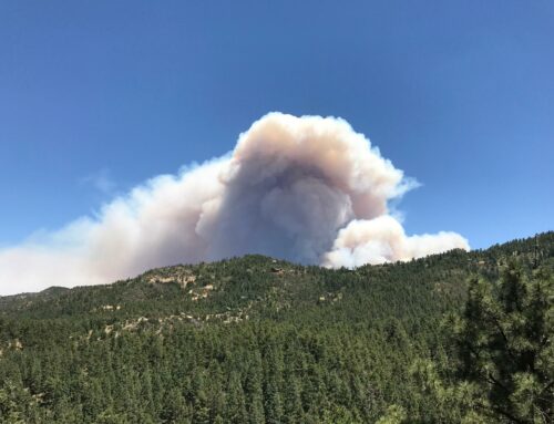
The north side of the fire continues to be the primary area of focus for fire fighters. Crews will be working across the top and on the north side of Big Bug Mesa to determine the best strategy for locating fire lines. Lots of progress has been made on the west, south and east sides of the fire as the fire is 25% contained.
Goodwin Fire Update; June 29, 5:00 PM
Release Date: Jun 29, 2017
Contact(s): Tiffany Davila: 602-540-1036
EOC Information Line: (928) 442-5103
Goodwin Fire Information Line: (928) 925-1111
Goodwin Fire Media Information Line: (928) 632-5055
Email: goodwinfireinfo@gmail.com
Website: https://inciweb.nwcg.gov/incident/5278
Facebook: www.facebook.comPrescottNF/
Tiffany Davila, Department of Forestry and Fire (602) 540-1036
Location: Bradshaw Ranger District of Prescott National Forest; 14 miles south of Prescott, AZ (T12N R1W, S28)
Start date: June 24, 2017, 4:00 p.m.
Size: Approximately 24,828 acres
Percent Contained: 25%
Cause: Under Investigation
Resources Assigned: Approximately 752 personnel
Vegetation: Predominantly dense chaparral and Ponderosa pine stands in drainages.
The evacuation for the community of Mayer was lifted as of 10:00am today. Please note there are significant road closures still in place.
Access to the community of Mayer is ONLY from the south. SR69 is open from I-17 north to Central Avenue in Mayer. SR69 will continue to be closed at Central Avenue in Mayer north to the intersection with SR169.
The following communities remain under mandatory evacuation: Pine Flat, Breezy Pines, Poland Junction, Chauncey Ranch Rd., Mt. Union, Walker, Upper Blue Hills, Potato Patch, Dewey west of SR69, Chaparral Hills, and Mountain Pine Acres.
Power was restored to most of Mayer early this afternoon. The structures providing power and water to Mayer were damaged by the fire. It was finally safe for Arizona Public Service (APS) to enter the fire area and assess and repair the equipment this morning. For Mayer residents without power, water is available at the Recreation Center in Mayer. If your power goes out, please let APS know by going to aps.com or calling their customer care center at 1-800-240-2014. Customers can be reimbursed for the purchase up to 40 lbs. of wet bagged ice or 20 lbs. of dry ice.
The Bradshaw Ranger District Closure remains in place. For a list of closed campgrounds on the district, see the information below.
The communities of Cleator and Crown King are OPEN and are not in the closure area.
CORRECTION – DONATIONS
People wanting to make donations can contact either Tony Figlerski with the American Red Cross at (928) 814-4999 or the Salvation Army at (928) 778-0150.
DRONE INTRUSION OVER THE FIRE: At this afternoon’s briefing, Air Operations reported that there were no additional “drones” within the airspace for the Goodwin Fire. This is good news for the team and fire personnel. An unmanned aircraft system (UAS) also known as a “drone” in the airspace associated with the fire would cause costly delays in firefighting efforts unduly threatening lives, property, and valuable natural and cultural resources. There is a Temporary Flight Restriction (TFR) over the fire area and it is illegal to fly a drone within the restricted area. Violators will be prosecuted to the fullest extent of the law. The community is reminded that “if you fly, we can’t fly.”
Summary:
The north side of the fire continues to be the primary area of focus for fire fighters. Crews will be working across the top and on the north side of Big Bug Mesa to determine the best strategy for locating firelines. Lots of progress has been made on the west, south and east sides of the fire as the fire is 25% contained.
Evacuations:
Walker, Blue Hills, Mountain Pine Acres, Dewey west of Hwy 69 excluding Prescott Country Club, Chauncey Ranch Road, Mt. Union
the area west of Highway 69, from Mayer to Poland Junction.
Poland Junction, Chaparral Hills and the Breezy Pines subdivision, Blue Hills, and Potato Patch
The evacuation remains in place for Pine FlatA shelter is in place at the Bradshaw Mountain High School, 6000 E Long Look Drive in Prescott Valley off of Glassford Hill Rd.
Pre-Evacuation:
A Pre-evacuation is still in effect for Orme School.
For additional information regarding evacuations and pre-evacuations please call the Yavapai County Emergency Operation Center at (928) 442-5103, 7am – 7pm.
Closures:
State Highway 69 is closed from Central Avenue in Mayer north to the Hwy 169 Junction.
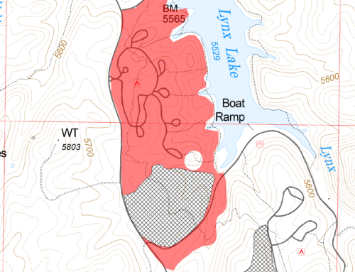
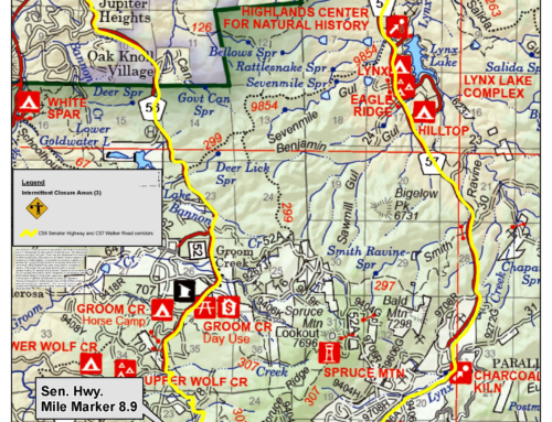
The Bradshaw Ranger District has expanded the Goodwin Fire area closure on Wednesday, June 28th at 6:00 am. Campgrounds and recreation opportunities in this area will be closed to the public as a precautionary measure to ensure public safety and to allow safe travel for those involved in the Goodwin Fire. Please visit the Prescott National Forest website (www.fs.fed.us/r3/prescott) or Inciweb (https://inciweb.nwcg.gov/incident/5278/) for a map of the closed area.The Bradshaw Ranger District is cancelling all campground reservations with recreation.gov for the next 2 weeks and freezing new reservations. Campers will be eligible for full refunds, but should retain their receipts to facilitate the process.
Recreation Sites/Areas Closed:
Lynx Corridor
Lynx Campground
Hilltop Campground
Eagle Ridge Group Campground
South Shore and North Shore Day Use Areas
Lynx Lake Store and Marina
Highland Center for Natural History
Groom Creek Corridor
Groom Creek Horse Camp
Groom Creek Schoolhouse and Picnic Area
Lower and Upper Wolf Creek Campgrounds
Forest Service-Permitted Organization Camps
Other Areas
White Spar Campground
All trails and trailheads within the closure area
All camping within our designated dispersed sites and primitive camping within the closure areaNote: Most recreation areas in the Prescott National Forest are NOT affected by the Goodwin Fire: List of Recreation Sites that are OPEN
For information on the closure please call the Bradshaw Ranger District at (928) 443-8000.

Leave A Comment