
Looks like the Horse Fire is about over.
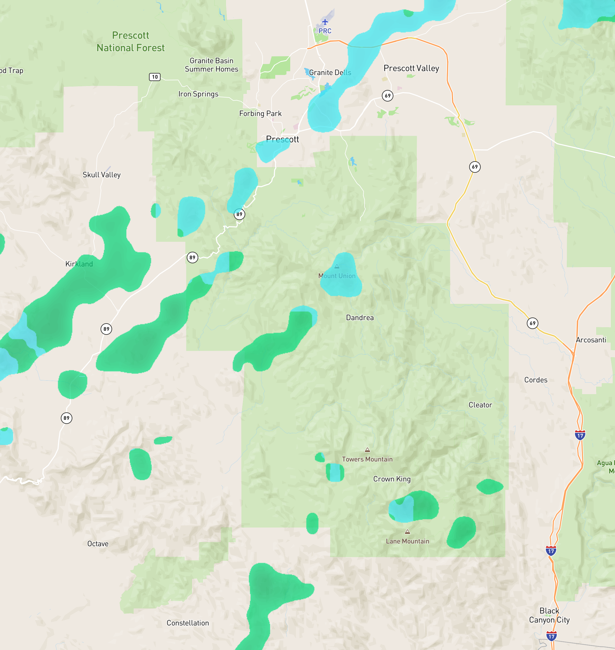
Location: 7 Miles Northwest of Crown King; 18 miles south of Prescott, AZ on the Bradshaw Ranger District (T1N, R2W, S24)
Start Date: 10-15-20
Size: 9537 Acres
Percent Contained: 74%
Cause: Human. Under investigation.
Vegetation: Juniper, Chaparral, and Timber
Summary: The Prescott National Forest assumed command of the Horse Fire on Sunday, October 25 at 9:00 pm. The fire remains at 9,537 acres and is currently 74% contained. Although there is no threat of fire spread or potential growth; firefighters will continue to patrol and monitor containment lines. As a low-pressure system enters the area, fire officials anticipate that lower temperatures and high chances of precipitation will help to moderate fire activity; but will keep a close watch on the northeast perimeter as gusty winds are predicted for Monday evening.
This will be the final news release unless there are significant changes in fire activity.
Closures: The Prescott NF has lifted the Horse Fire Area Closure at 6:00 am on Monday, October 26, 2020. We ask that the residents of Crown King and the public please stay out of the fire area, as post fire hazards still exist; and we ask that you stay off the following roads as emergency fire road repair is occurring – FSR 52 from Palace Station to Crown King and FSR 52 south from Hooper Saddle to Minnehaha. Please use County Road 59 to access the community of Crown King.
Reminder – Stage 1 Fire Restrictions remain in effect across Prescott National Forest.
The public can obtain additional information via the following:Prescott NF Forest Website: http://www.fs.usda.gov/prescott/
Twitter: @PrescottNF
Facebook: https://www.facebook.com/PrescottNF/
Fire Information for the Prescott National Forest: 928-925-1111Read the entire article at: https://www.fs.usda.gov/


Leave A Comment