
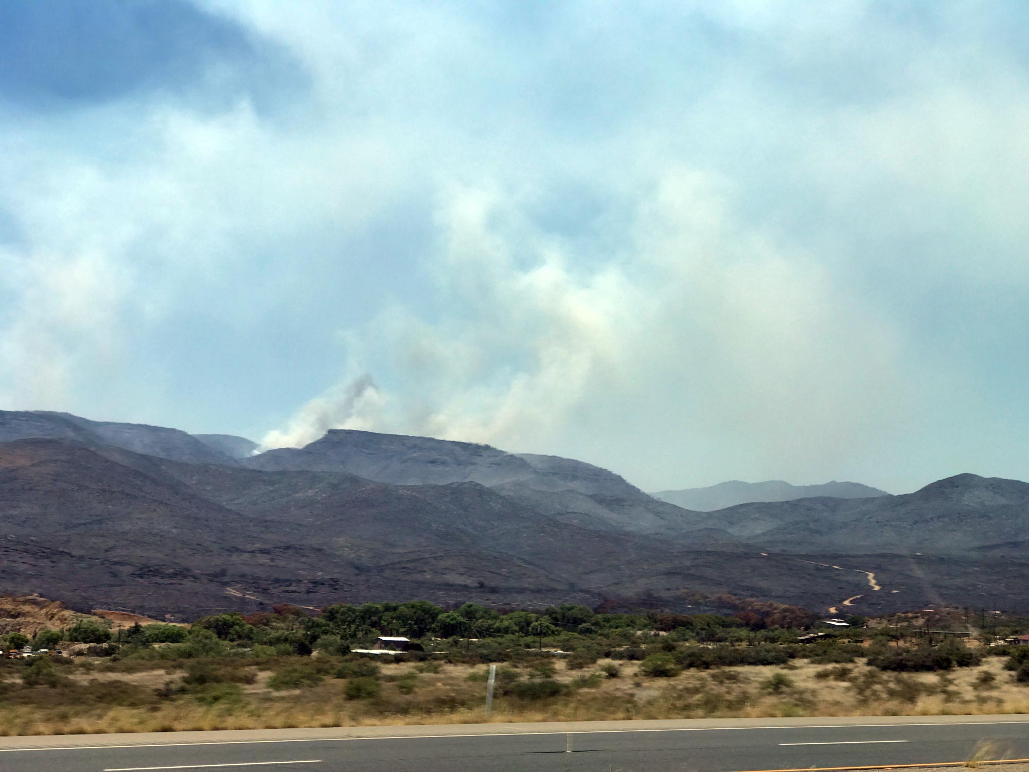
Photo was taken from highway 69, between Mayer and Poland Junction, looking West, towards Big Bug Mesa.
You need to know:
Percent Contained: 53%
Size: Approximately 25,714 acres
Resources Assigned: Approximately 1,223 personnel
There were some pockets of interior burning today along the northern portion of the fire west of Poland Junction.
Firefighters plan to use extensive hoselays to apply water to the fire in that portion of the fire overnight.
Two excavators are being used along the eastern side of the fire to rehabilitate fire lines.
https://inciweb.nwcg.gov/incident/article/35993
Goodwin Fire Evening Update, Saturday, July 1
Incident: Goodwin Fire Wildfire
Information Line: (928) 925-1111
Goodwin Fire Media Information Line: (928) 632-5055
Email: goodwinfireinfo@gmail.com
Website: https://inciweb.nwcg.gov/incident/5278
Facebook: www.facebook.comPrescottNF/
Tiffany Davila, Arizona Department of Forestry and Fire Management (602) 540-1036Goodwin Fire
July 1, 2017, 7:00 p.m.
Location: Bradshaw Ranger District of Prescott National Forest; 14 miles south of Prescott, AZ (T12N R1W, S28)
Start date: June 24, 2017, 4:00 p.m.
Size: Approximately 25,714 acres
Percent Contained: 53%
Cause: Under Investigation
Resources Assigned: Approximately 1,223 personnel
Vegetation: Predominantly dense chaparral and Ponderosa pine stands in drainages.There were some pockets of interior burning today along the northern portion of the fire west of Poland Junction. Firefighters plan to use extensive hoselays to apply water to the fire in that portion of the fire overnight. Two excavators are being used along the eastern side of the fire to rehabilitate firelines.
Today the Yavapai County Sheriff’s Office arrested a person for operating an unmanned aircraft, commonly referred to as a drone, in the airspace of the Goodwin Fire. On June 28th, numerous firefighting aircraft were being used on the fire at the time the drone was spotted. Because of this intrusion the airspace had to be immediately cleared due to the danger the drone posed to aircraft. The public is reminded that the use of drones near wildfires is illegal and can cause the loss of homes and possible injury or death of members of the public and or firefighters.
Evacuation information: Although some evacuations have been lifted and roads reopened, property owners are urged to remain vigilant and monitor fire news. There is still active fire behavior, particularly in the northern portion of the fire, and conditions can change easily if impacted by high wind events.
Evacuations have been lifted for some areas: At 10 am this morning, July 1, 2017, evacuation orders were lifted for the following communities/areas: Blue Hills (power has been restored), Upper Blue Hills (power has been restored), Dewey/Humboldt all areas west of SR 69 south to mile post 280. (west Poland Junction remains under evacuation)
These communities remain under mandatory evacuation: SR 69 – west side from Grapevine Road north to Milepost 280, Poland Junction- west side, Pine Flat, Breezy Pines, Walker, Potato Patch, Mount Union, Mountain Pine Acres.
Please note: The Blue Hills/Upper Blue Hills area has fire suppression sprinklers that were installed by firefighters in various portions of the community. Please keep these areas clear and allow fire officials access to do their work.
For additional information regarding evacuations and pre-evacuations please call the Yavapai County Emergency Operation Center at (928) 442-5103, 7am – 7pm.
National Forest (www.fs.fed.us/r3/prescott) or Inciweb (https://inciweb.nwcg.gov/incident/5278/) for maps of closed areas.


Leave A Comment