CLICK HERE FOR THE LATEST NEWS ABOUT THE MINE – Victory!
I am NOT the author of the petition. I posted this here just for awareness in the community. I can’t verify any of it’s claims.
A Foreign Owned Strip Mine Threatening 800 Forested acres just south of Prescott, AZ.
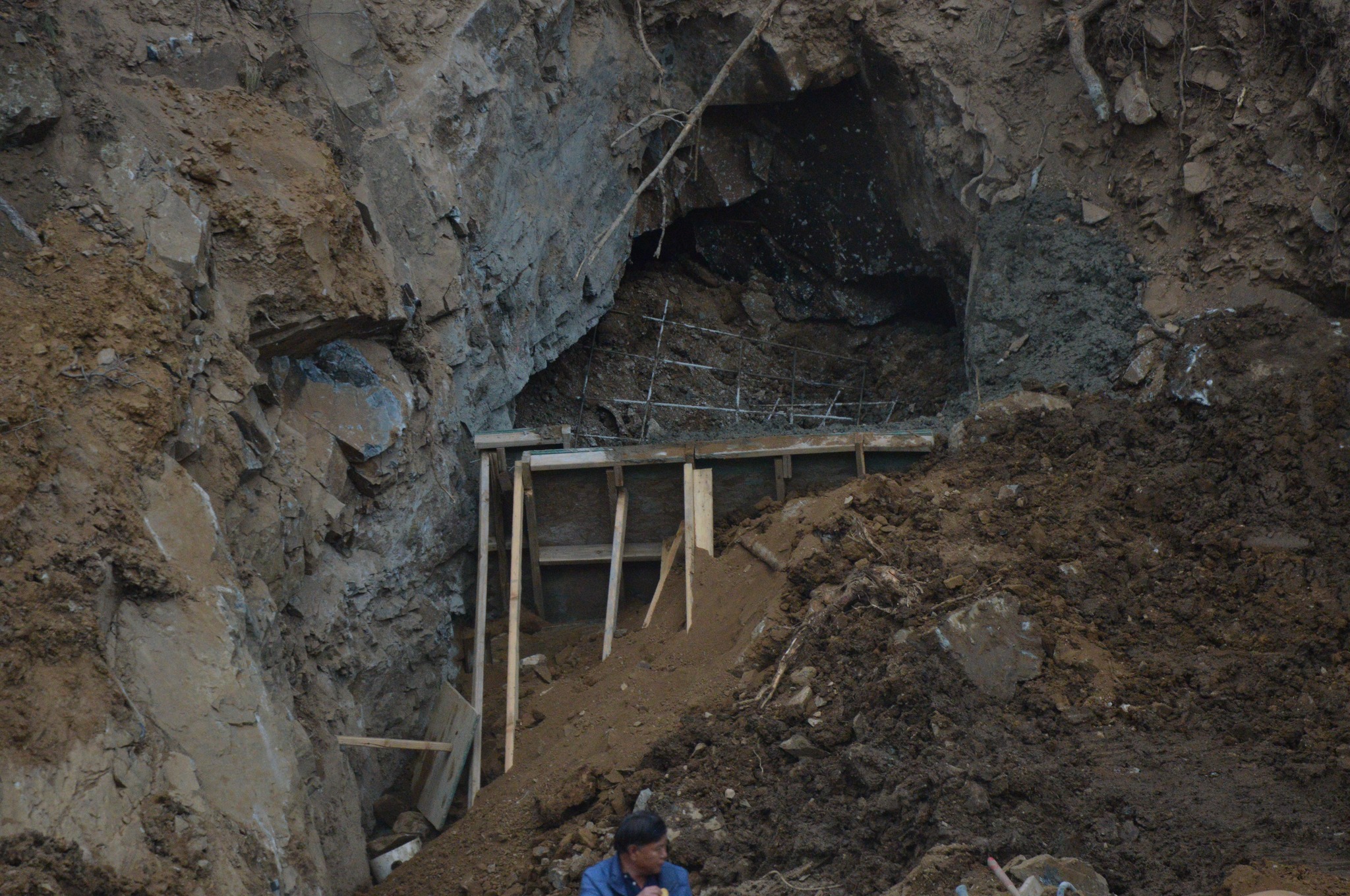
Our community, encompassing Walker, Potato Patch, Groom Creek, Hassayampa Lake, Whispering Pines and Misty Mountain among others is under threat. A strip mine owned by an affiliate of the Chinese Government (Gold Paradise Peak Inc) has begun operations in our residential neighborhood without ANY prior notice to the area residents. This operation plans to strip over 800 acres of forest and excavate the mountain side along Senator Hwy up to 900 feet deep, devastating this area for centuries to come. The impact is already visible on our property which lies adjacent to the mining operation. Trees have been destroyed without permission for road widening activities that disregard private property.
Read the entire article at: https://www.change.org/


What is your evidence that Gold Paradise Peak is owned by a Chinese entity? Their homepage says they are a California company who exports gold to China.
Maybe because it’s stated on their website?
I don’t care where they are from, have you ever seen a forest strip mined! It turns from Beauty to Ugly really fast! Wake up before its too late! Look up strip mining to reaffirm what I said! Don’t trust my word!
Indeed, residents don’t want a strip mine in their back yard, so no it doesn’t matter who owns the mine, but given that the Chinese have been buying up our farm land along with billionaires like Bill Gates, it is not a far stretch. I am sure the owners are not philanthropists or they would not be mining land so close to residential areas and National Forests.
This appears to be an active mine. I have not driven past the location, but here is the website describing the “Senator Mine”, including overview, plans, maps, etc. https://goldppi.com/senator.html
Does anyone have a map of the area this is located? How are they hauling it away, is it on Senator Highway or Walker Road?
NIMBYs, u all literally live on private inholdings that exist because of historic mining in the area. Walker and groom Creek only exist because of mining. This it totally within their right and by Law can extract these resources. In fact your modern life and technology depends on it. Stop trying to change everything because you moved to a location.
Yes, when searched the firm, Gold Paradise Peak, Inc. does come up as a “California based international firm in San Mateo, CA”. If you research further –
Source: https://ecorp.azcc.gov/BusinessSearch/BusinessInfo?entityNumber=F22201899, you will find:
Entity Details
Entity Name: GOLD PARADISE PEAK INC. Entity ID: F22201899
Entity Type: Foreign For-Profit (Business) Corporation Entity Status: Active
Formation Date:9/18/2017 Reason for Status:
In Good Standing
Approval Date:7/24/2018 Status Date:
Original Incorporation Date:9/18/2017 Life Period: Perpetual
Business Type: Mining, Quarrying, and Oil and Gas Extraction Last Annual Report Filed:2023
Domicile State: Nevada Annual Report Due Date: 9/18/2024
Principal Information
Title Name Address Date of Taking Office Last Updated
Treasurer GANG CHEN 710 5th Street, PRESCOTT, AZ, 86301, Yavapai County, USA 9/1/2020 8/26/2021
Director ZEYA ZHANG 710 5th Street, PRESCOTT, AZ, 86301, Yavapai County, USA 9/1/2020 8/26/2021
Director HONGBIN LIN 710 5th Street, PRESCOTT, AZ, 86301, Yavapai County, USA 9/1/2020 8/26/2021
President/CEO SONGQIANG CHEN 710 5th Street, PRESCOTT, AZ, 86301, Yavapai County, USA 9/18/2017 8/26/2021
Secretary GANG CHEN 204 WEST SPEAR STREET #3597, CARSON CITY, NV, 89703, Carson City County, USA 9/1/2020 8/26/2021
Address
Attention: Address: 710 5th Street, PRESCOTT, AZ, 86301, USA County: Yavapai Last Updated: 8/28/2023
Entity Principal Office Address
Attention: Address: 204 WEST SPEAR STREET #3597, CARSON CITY, NV, 89703, USA County: Carson City Last Updated: 8/28/2023
Look it up if you don’t believe what I posted. I believe the key to the description of the firm is “international”. Bottom line – the Chinese are destroying, polluting, & encroaching upon wildlife on United States soil in order to send the products that are raped from US soil to China. WTF is wrong with the US National Forest?
Who was the coruptacrat that approved this in the first place?
If the residents were creative they’d organize a group to take shifts travelling at ‘safe’ speeds for a bumpy dirt road. If trucks get delayed due to traffic, that would be unfortunate for them.
Mines can afford a lot of means, but time. If trucks can’t leave or return at a rate that meets their production needs, profitabilty declines.
HAS TO STOP. Modern life as someone writes might need these materials, but if the planet is destroyed getting them out of the ground, plus destroying the lives of humans living in the area (which it will) there is no basis to continue this insanity.
From what I can determine the International in the company description is a way of saying Chinese without saying Chinese.
When these companies leave an area, they leave destruction, devastation, pollution and try and get them to fix the mess once they are back in Beijing or wherever!
THEN THIS which is early in the project and violations will no doubt increase.
Violation Tracker Individual Record
Company: Gold Paradise Peak Inc
Penalty: $9,979
Year: 2023
Date: March 28, 2023
Offense Group: safety-related offenses
Primary Offense: workplace safety or health violation
Secondary Offense: mining violation
Agency: Mine Safety and Health Administration
Civil or Criminal Case: civil
Facility State: Arizona
Facility City: Prescott
Source of Data: Extracted from a copy of MSHA’s Violations Data Set updated 3/8/2024, available at (click here)
MSHA Violation Number: 9726511
MSHA Mine Name: The Azurite – Senator Mine
This is as far as I can determine the company behind addresses in CA, NV and Prescott
ZHENGZHOU LICHENG ZHIXIN ELECTRONIC
TECHNOLOGY CO. , LTD. A
Shawn wrote:
https://goldppi.com/senator.html
Link is dead. Obviously they will hide as much as possible.
DOES anyone know where the product will be transported to? North, South, East or West of Prescott. Just what our roads in the area will need. 20 hour heavy truck traffic.
They have the mine business office at 710 5th street in Prescott.
Oh my! I just checked the assessors map of the mines combined holdings and they could literally take half the top of mount Tritle off, that ugly scar will be visible for a hundred miles around and also gut out a huge section of Senator Highway.
People have made this claim on the beheading of Mt Tritle. Can someone (Ken Harrington?) point me towards the approved mining plan so we all can see? Tony Hamer, Host of Eye on Prescott, Prescottlive.com
Go on the yavapai county GIS parcel search site, zoom in on that area and select the “identify” button and select the parcels surrounding the mine site. Look at the address of the owners. One parcel owned by the same party’s owning the mine site own a section that runs right over the top of mt Tritle. No single parcel equals 800 acres so from their description they plan to mine 800 acres.
Thanks Ken for your guidance and I have located two GPPI properties on the GIS map, and also one for Sino Vantage (co-investor and distribution partner). Do you know of other parties who might be allied with these 2 property owners?
Others that seem to have a connection are Freshion Inc 1650 S Amphlett Blvd Ste 212 San Mateo, CA and possibly Wang Leo L 969G
Edgewater Blvd # 350 San Mateo, CA. both of these are P. O Box type locations.
There are also numerous mining claims that are not easily searchable located on Forest Service land in between the Owned parcels.
On the GIS page under the “Layers” drop down menu click “Land Features” then click “Mining claims” to see them. The “Mining claim Labels”
can also be turned on for a bit more info.
I also came across an outfit that helped slow down another mine on the Hassyampa in 2020, Contact:
Joe Trudeau, (928) 800-2472, [email protected] website:
https://biologicaldiversity.org/w/news/press-releases/prescott-national-forest-withdraws-approval-hassayampa-river-gold-mine-2020-07-02/
For those that were trying to find the Goldppi website that had been taken down I found it on The Way Back Machine, here is the link to that, since removed page:
https://web.archive.org/web/20230330013815/http://goldppi.com/senator.html
From the website they expect 5 grams per ton of ore, it also says “reserve of 1M oz’s” That would require the removal of 5,600,000 tons of earth to extract not counting the additional overburden removal for access to the ore. They say a “strip ratio of less than 1” If I understand correctly they mean 1:1 which means they may remove 1 ton of overburden for each ton of ore so double that 5,600,000 to 12,000,000 tons. My math may be off but that is something like 17.7+ million cubic yards of earth removed.
Tony, 2 others seem likely, Freshion Inc 1650 S Amphlett Blvd Ste 212 San Mateo, CA and possibly, Wang Leo L 2007 Living Trust 969G Edgewater Blvd # 350 San Mateo, CA. to the north over the top of Mt. Tritle which is next to another Gold Paradise section.
There are also Mining claims in between the Owned sections that are harder to track ownership of. You can view those on the GIS site by clicking on the “Layers” pull down menu, click on “Land features” and select “Mining claims” and “Mining claim Labels”
Does the roadwork on Senator Highway have anything to do with the mine? A reply from the city someone told me about said they were widening the road to have a place to pile plowed snow! This seems pretty unlikely and my thought is the roadwork is to accommodate heavy trucks and mining equipment.
This must stop now. This type of operation should require all residents to be notified with 30 miles of the operation. This cant stand.
This needs to be stopped NOW!
Sadly, this has discouraged from looking for property in this area. It is, however, uplifting to see a realtor sharing this information.
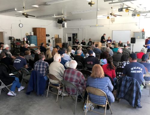
Any updates on recent community meeting?
ADEQ’s Emergency Actions Address Immediate Environmental Threats to Hassayampa River from Senator Mine
Just got this notice from ADEQ. Have there been any updates since the meeting in April regarding Gold Peak Paradise activity along Senator Highway and Mount Tritle?
Hi I’m Evelyn Rayburn 6 miles below the top of Mt. Tritle in Groom Creek. We are experiencing fluctuating water. Are neighbors above us, and below us are having lower water pressure too.What is the status of the mine? Last I heard the mining company was closing. However, why are they widening the Senator highway? Is it too late to sign the petition, and is there a class action suit?