
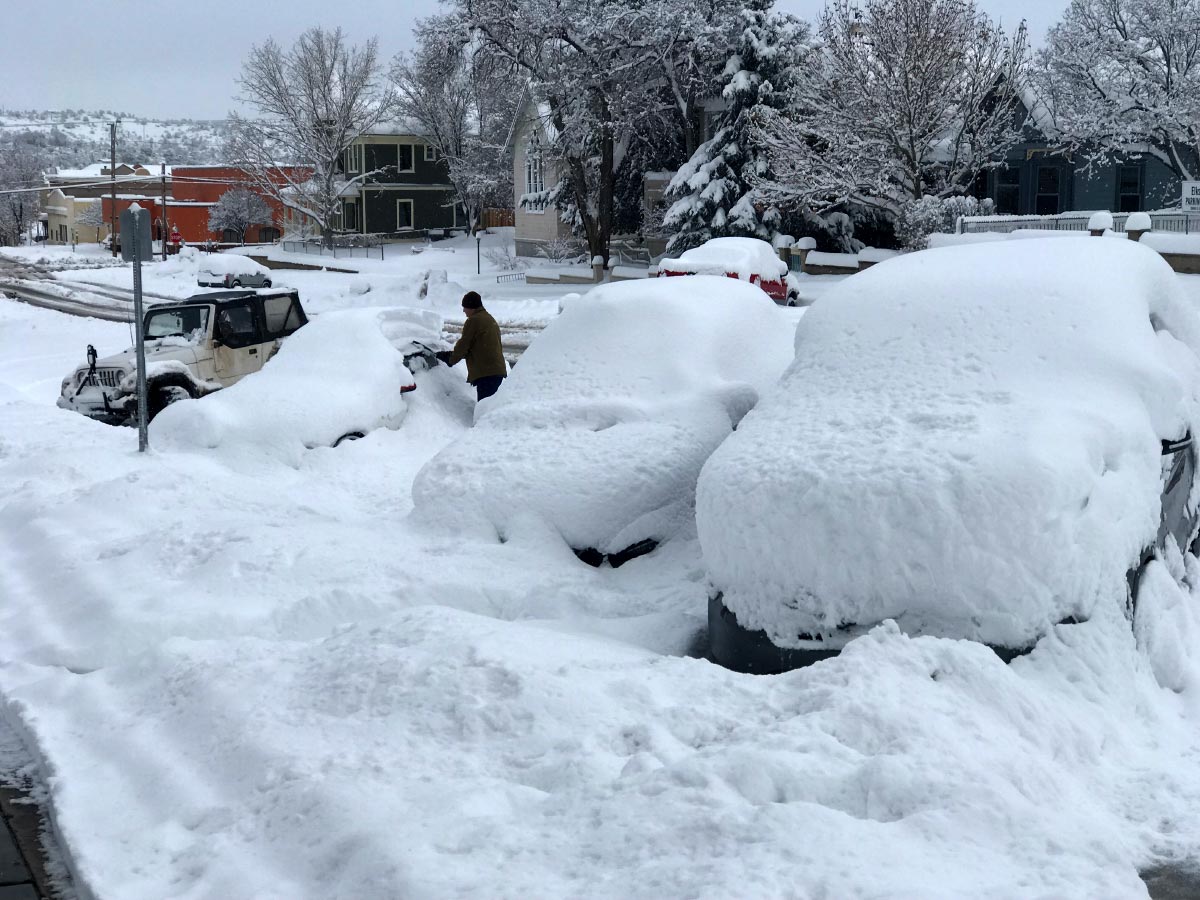
It’s coming. Get ready.
If you’re not in Walker, stay away from Walker.
…WINTER STORM WATCH REMAINS IN EFFECT FROM TUESDAY EVENING
THROUGH WEDNESDAY EVENING…* WHAT…Heavy snow and blowing snow possible. Total snow
accumulations of 4 to 12 inches possible, with higher
accumulations over the highest peaks. Winds could gust as high
as 60 to 70 mph.* WHERE…Areas near Alpine, Buffalo Pass, Doney Park,
Flagstaff, Forest Lakes, Fredonia, Ganado, Grand Canyon, Heber-
Overgaard, Jacob Lake, North Rim, Pinetop-Lakeside, Prescott,
Prescott Valley, Sedona, Seligman, Shonto, Show Low, Valle,
Whiteriver, Williams and Window Rock.* WHEN…From Tuesday evening through Wednesday evening.
* IMPACTS…Travel could be very difficult to impossible.
Widespread blowing snow could significantly reduce visibility.
The hazardous conditions could impact the morning or evening
commute. Very strong winds could cause extensive tree damage.Snow forecast from 8 PM Tuesday to 11 PM Wednesday:
Alpine 5 to 9 inches Buffalo Pass 4 to 8 inches
Doney Park 5 to 9 inches Flagstaff 6 to 10 inches
Forest Lakes 12 to 18 inches Fredonia 1 to 3 inches
Ganado 2 to 4 inches Grand Canyon 4 to 6 inches
Heber-Overgaard 4 to 8 inches Jacob Lake 4 to 8 inches
North Rim 6 to 10 inches Pinetop-Lkside 7 to 11 inches
Prescott 1 to 3 inches Prescott Valley 1 to 3 inches
Sedona 3 to 5 inches Seligman 2 to 4 inches
Shonto 2 to 4 inches Show Low 5 to 9 inches
Valle 3 to 5 inches Whiteriver 4 to 8 inches
Williams 5 to 9 inches Window Rock 2 to 4 inches
.Read the entire article at: https://www.wunderground.com/severe/us/az/prescott/KAZPRESC34


Thanks Conrad, you’re a good friend and neighbor to the Walker community!