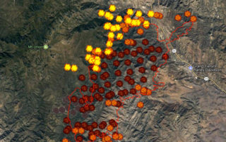
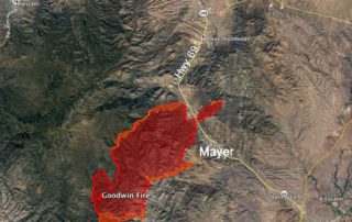
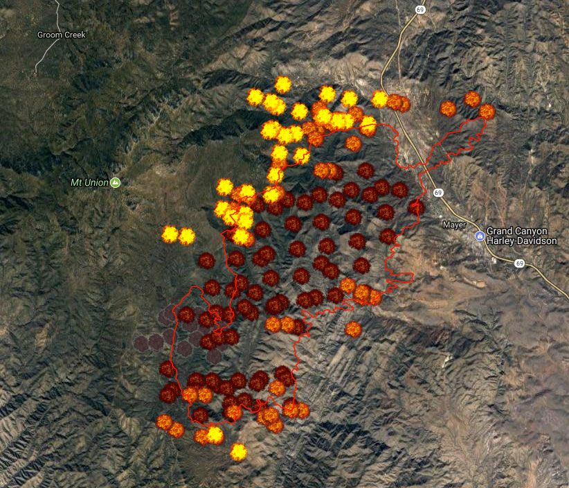
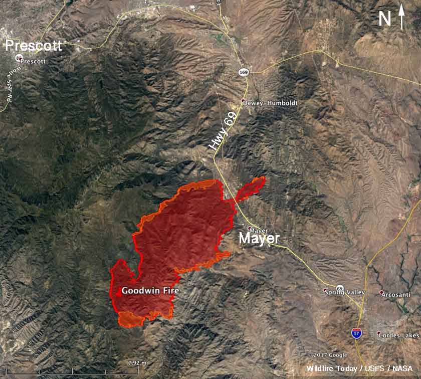
Goodwin Fire Evening Update 6-28 at 8:00pm

Scroll down and read the Summary section.

There’s some mild good news. Basically, today didn’t suck as bad as yesterday.

https://inciweb.nwcg.gov/incident/article/35925

Incident: Goodwin Fire Wildfire

EOC Information Line: (928) 442-5103

Goodwin Fire Information Line: (928) 925-1111

Email: goodwinfireinfo@gmail.com

Website: https://inciweb.nwcg.gov/incident/5278

Facebook: www.facebook.com/PrescottNF/

Goodwin Fire

June 28, 2017, 8:00 p.m..

Location: Bradshaw Ranger District, of Prescott National Forest; 14 miles south of Prescott, AZ […]

By |2017-06-29T00:13:20-07:00June 28th, 2017|0 Comments

Mandatory Evacuation in Walker?

There are two guys at Walker Road and Big Bug turning people back trying to go on Big Bug.

There was some meeting, or not, at the fire station at 9:00am this morning. I didn’t get any notice, so I’m not sure what it was.

The Sheriff Jeep Posse pulled into the parking lot as […]

By |2017-06-28T10:00:04-07:00June 28th, 2017|0 Comments

Wildfire Today – Goodwin Fire Info

From WildFireToday:

http://wildfiretoday.com/2017/06/28/goodwin-fire-crosses-highway-69-at-mayer-grows-to-20000-acres/

Wednesday morning the Goodwin fire was five times larger than it was 24 hours earlier.

Southwest winds and low humidities caused it to spread to the northeast threatening the town of Mayer, Arizona which was under a mandatory evacuation order.

It crossed highway 69 just north of the town and as […]

By |2017-06-28T08:47:59-07:00June 28th, 2017|0 Comments

Yavapai County Sheriff’s Office Update – 10pm Tuesday

https://www.facebook.com/YavapaiCountySheriff/posts/1891714791071712:0

10:00 PM- Goodwin Fire Pre-evacuation notice for the Dewey – Humboldt area — please see the map —

The actual alert: http://onsolve360.com/alert?id=8-740130

By |2017-07-30T19:18:19-07:00June 27th, 2017|0 Comments

MODIS C6 – Satellite Location of Goodwin Fire Over Time

Using the MODIS C6 KML file and Google Earth, I created this movie to illustrate the movement of the fire.

KML file is available here:
https://earthdata.nasa.gov/earth-observation-data/near-real-time/firms/active-fire-data

The time starts before the fire starts and ends at 2:00pm Tuesday afternoon (today).

This is looking south. Walker is at the bottom. The little red dot is […]

By |2017-06-27T19:53:59-07:00June 27th, 2017|1 Comment
Go to Top